
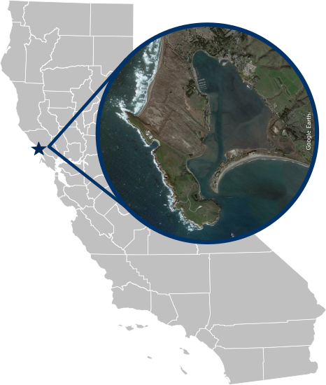
Bodega Harbor, located on California’s North Coast in Sonoma County, is a shallow, tidally influenced embayment connected to the Pacific Ocean. Unlike many smaller estuaries, Bodega Harbor remains open year-round, with strong tidal exchange shaping water levels, salinity, and circulation. The harbor is fed by several small creeks and influenced by ocean conditions, including wind-driven upwelling that brings cold, nutrient-rich water into the area.
The harbor supports a mix of open water, tidal marsh, mudflat, and eelgrass habitats, providing important foraging and nursery areas for fish, shellfish, shorebirds, and marine mammals. It also serves as a hub for fishing, boating, and research activity. Low-lying areas around the harbor, including portions of the town of Bodega Bay, are vulnerable to tidal flooding, storm surge, and long-term sea level rise.
Water level monitoring in Bodega Harbor helps track tidal dynamics, storm impacts, and the influence of regional oceanographic conditions. These data are essential for understanding local flooding risks, supporting habitat management, and informing planning decisions in a working waterfront that is both ecologically and economically significant.